Trails
Sourced from official notices. Check status before you go.
Results: 139 trails
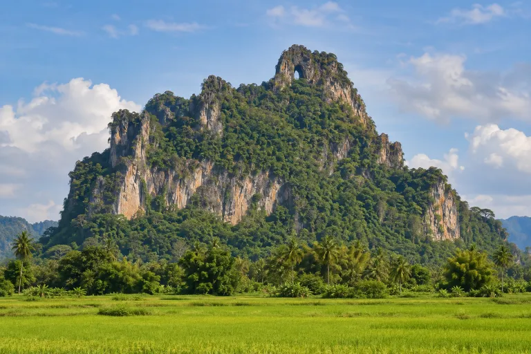
เขาอกทะลุ
Khao Ok Thalu
Khao Ok Thalu is a limestone mountain in central Phatthalung, approximately 250 metres above mean sea level, with an opening near its summit. DASTA describes an ascent of 1,066 steps taking about 30 minutes to the opening, with a further ascent to the summit.
Phatthalung · 1 day · Planning-ready

เขาล้อนนมสาว
Khao Lon Nom Sao
Khao Lon Nom Sao is a trekking route in Khao Banthat Wildlife Sanctuary, Phatthalung; TrekkingTHAI describes a moderate-to-hard, three-day, two-night itinerary combined with Nan Yipun Waterfall. Thai PBS reported a planned reopening on 18 June 2026 following a temporary closure to improve safety measures.
Khao Banthat Wildlife Sanctuary · 1 day · Planning-ready

ฆูนุงซีลีปัต
Gunung Silipat
Gunung Silipat is a 607-metre summit in Betong, Yala, with 360-degree views of mist-filled valleys. It can be visited as a day hike or with overnight camping; walking distance varies by access route.
Yala · 1 day · Planning-ready

ผาอโศก
Pha Asok
This mist viewpoint is in Sukhirin District, Narathiwat. Remawadee describes a difficult route taking approximately two hours to ascend.
Narathiwat · 1 day · Planning-ready

น้ำตกโตนไทร–เขาพระแทว
Ton Sai Waterfall &Khao Phra Thaeo Wildlife Sanctuary
The Ton Sai Waterfall nature trail is in Khao Phra Thaeo forest, Thalang District, Phuket. This record covers the 2 km long loop, distinct from the crossing to Bang Pae Waterfall.
Phuket · 1 day · Planning-ready

เขาหัวแหวน
Khao Hua Waen
Hiking Guide lists เขาหัวแหวน in Ranong, but the fetched listing provides no trail details.
Ranong · 1 day · Planning-ready

เขาพ่อตามังเคร
Pho Ta Mangkre Summit
Pho Ta Mangkre Summit is in Phato District, Chumphon, at 970 metres above sea level. Fetched travel sources describe a two-day, one-night trek with summit camping and guidance from staff or knowledgeable local residents.
Chumphon · 1 day · Planning-ready
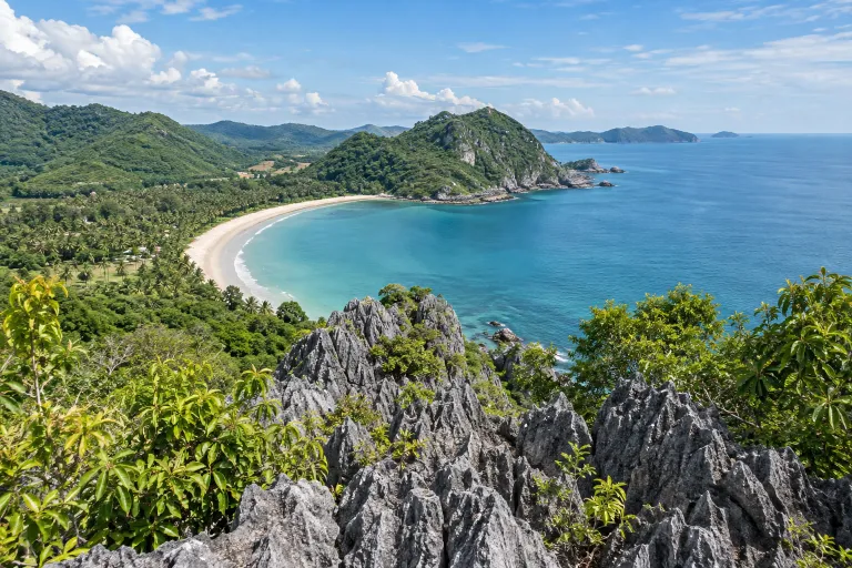
เขาทุ่งยาง
Khao Thung Yang Viewpoint
Khao Thung Yang is a viewpoint hike near Thung Yang Beach in Chumphon, starting behind Happy Bar at a slope marked with a red rope. A community trip report describes approximately 200 metres to the summit, including rope-assisted scrambling.
Chumphon · 1 day · Planning-ready

เลอกวาเดาะ
Loe Kwa Do
This mountain hike in Mae Wa Luang, Tha Song Yang District, Tak starts at Wat Pa Krae Khi, with a reported one-way distance of 3.8 km to the summit pagoda. Published itineraries describe two days and one night, camping and returning along the same trail.
Tak · 2 days · Planning-ready

ดอยหัวทู่
Doi Hua Thu
2 days 1 night [ชุมชน] — ทุ่งหญ้าเปิด เห็นพระอาทิตย์ขึ้นและตก · Distance, elevation, season and access not yet checked against an official source (from the owner's list).
Tak · 2 days · Planning-ready

ดอยมณฑา
Doi Montha
Doi Montha is a trek in Taksin Maharat National Park, Tak, accessed through Poo Pae village. Published itineraries describe two days and one night of tent camping, following streams and steep ridges.
Taksin Maharat National Park · 2 days · Planning-ready

ม่อนสี่สหาย
Mon Si Sahai
Mon Si Sahai is a hiking destination in Tak with a two-day, one-night camping itinerary. A tour operator describes approximately 6.5 km of walking from the trailhead to camp, returning along the same trail on day two.
Tak · 2 days · Planning-ready