Trails
Sourced from official notices. Check status before you go.
Results: 139 trails

เขาหน่อ–เขาแก้ว
Khao No - Khao Kaeo
Khao No–Khao Kaeo is a limestone hill attraction in Ban Daen, Banphot Phisai, Nakhon Sawan, with a day hike starting at Wat Khao No. The ascent to Khao Phra Phutthabat uses 700 steps and five ladder sections.
Nakhon Sawan · 1 day · Planning-ready
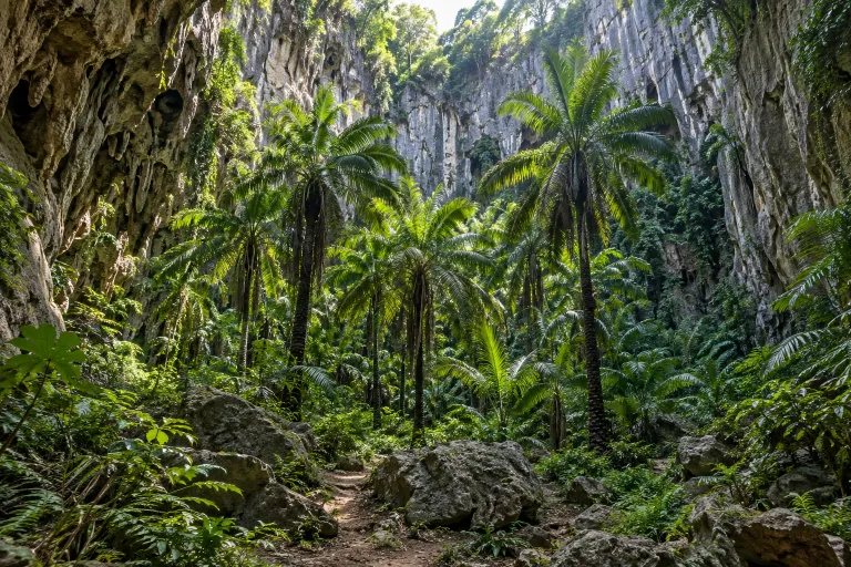
หุบป่าตาด
Hup Pa Tat
Hup Pa Tat is a nature walk in the Tham Prathun Non-hunting Area, Lan Sak District, Uthai Thani. Visitors pass through a cave into a forest of tat palms; the approximately 700-metre round trip can be explored independently.
Uthai Thani · 1 day · Planning-ready

ดอยหัวหมด
Doi Hua Mot
Doi Hua Mot is a limestone ridge in Umphang district, Tak, with sunrise and sea-of-mist viewpoints. The second viewpoint is reached by an approximately 300-metre uphill walk from the parking area at kilometre 10.
Umphang Wildlife Sanctuary · 1 day · Planning-ready

ดอยผาตั้ง
Doi Pha Tang
Doi Pha Tang is in Po Subdistrict, Wiang Kaen District, Chiang Rai, on the Thai–Lao border, with viewpoints and the natural rock opening called Pha Bong or Siam Gateway. Thai Wikipedia describes an approximately 700-metre ascent trail starting beside the parking area.
Chiang Rai · 1 day · Planning-ready

ภูชี้ฟ้า
Phu Chi Fa
Phu Chi Fa is a viewpoint in Chiang Rai at 1,628 metres above sea level, overlooking a sea of mist at sunrise. A Ministry of Tourism and Sports guide describes a walk of approximately 700 metres each way from the forest park parking area.
Phu Chi Fa National Park · 1 day · Planning-ready

ดอยสวนยาหลวง
Doi Suan Ya Luang
Doi Suan Ya Luang is near Ban San Charoen in Tha Wang Pha, Nan, with coffee plantations and local homestays. Chillpainai describes an approximately 8 km return summit walk from the accommodation used in its report.
Nan · 1 day · Planning-ready

ภูแผงม้า
Phu Phaeng Ma
Phu Phaeng Ma is a viewpoint in Phu Hin Rong Kla National Park overlooking sunrise, sunset and morning mist during the cold season. Thai-Tour describes a 400-metre walk up from the parking area.
Phu Hin Rong Kla National Park · 1 day · Planning-ready
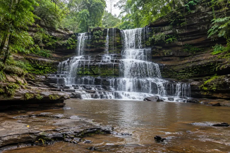
น้ำตกตาดใหญ่
Tat Yai Waterfall
One-day hike · Distance, elevation, season and access not yet checked against an official source (from the owner's list).
Phu Pha Man National Park · 1 day · Planning-ready

ภูบ่อบิด
Phu Bo Bit
Phu Bo Bit is a viewpoint hike in Mueang Loei; the provincial public relations office reports a summit elevation of 520 metres and 360-degree views. One starting point is the parking area at Trai Sawan monastic retreat, while a travel guide reports a 670-metre uphill walking route.
Phu Bo Bit Forest Park · 1 day · Planning-ready

ภูทอก
Phu Thok
Phu Thok is a sandstone mountain in Si Wilai District, Bueng Kan, with Wat Chetiya Khiri Wihan situated on Phu Thok Noi. The ascent starts at the temple and follows wooden stairs and walkways arranged across seven levels.
Bueng Kan · 1 day · Planning-ready
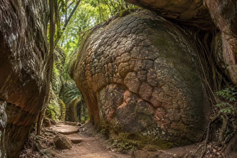
ถ้ำนาคา
Naka Cave
Naka Cave lies in Phu Langka National Park, Bueng Khong Long district, Bueng Kan, and has rock patterns resembling snake scales. TAT describes an approximately 1.4-kilometre ascent and a 4–5-hour return visit.
Bueng Kan · 1 day · Planning-ready
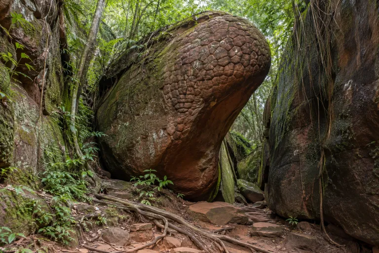
ถ้ำนาคี
Nakhi Cave
Nakhi Cave is in Phulangka National Park, Nakhon Phanom, with an approximately 3 km return walk starting at the park headquarters. The trail connects with Tat Pho Waterfall, and Kapook reports that a park guide is required.
Phulangka National Park · 1 day · Planning-ready